
There’s a stretch of about six weeks — late September through the first days of November — when the mountain is at its most colorful and its least crowded. Vine maple and cottonwood go gold all the way down the river valleys, the huckleberry ground-cover under the subalpine firs turns red, and the summer traffic is gone. Cool days, cold nights, and weather that can turn over twice before lunch. Then on a crisp hot-apple-cider morning, the mountain shows up.
The park is open around the clock in October, and you pay the $30 vehicle fee at the gate — good for the whole trip. From November 1 the road above Longmire goes gate-controlled, 9 a.m. to 4 p.m., so a trip that runs into November wants Paradise in the middle of the day.
Here’s the loop.
The Loop Itinerary
One circle around the mountain, about 300 miles: in through the quiet southwest, across the bottom through Packwood, out over Cayuse and Chinook.
Expect an October high around 54°F, lows around 35°F, about 9 inches of rain across the month against an inch or two in July, and dark by 6:30 p.m. where a July evening holds light past 9.
| Day | Where you sleep | Zone |
|---|---|---|
| 1 | Alder Lake Campground | Southwest approach, outside the park |
| 2 | FR 21 dispersed or back to Alder | South — Longmire/Paradise — Packwood |
| 3 | FR 21 dispersed or back to Alder | Southeast — Stevens Canyon |
| 4 | Back to Seattle | East — Chinook Pass — Sheep Lake/Crystal Resort |
Open the full loop in Google Maps
Most folks haven’t heard of onX — it maps national forest roads, ownership boundaries and dispersed sites, and it keeps working offline where you’ll have no signal.
Import the GPX in onX or your preferred mapping service — includes the route with campsite spots at Alder Lake Campground and dispersed options on FR 21 in Gifford Pinchot NF.
Where you sleep is up to you
The loop passes both. Mix and match night by night — neither takes a reservation after mid-Sept.
A · Alder Lake Campground — Hwy 7 near Elbe, 30 minutes from the Nisqually Entrance. $25 tent site, walk-in only, September 16 to December 19. Nothing to book and near empty midweek. Flush toilets, coin-op hot showers, lake out the door. Bring quarters. Take a tent site with a parking pad rather than a hookup site — the power station and water keg cover you, and hookups just cost $15 to $20 more.
B · Dispersed on FR 21 — national forest south of Packwood, on a leg of the WABDR. Free, no reservation, no neighbors. Two we like:
- 46.45765, -121.52334 — near the Berry Patch trailhead, easy to pull into. It’s the busier of the two in summer; midweek in the shoulder season you’ll have your pick.
- 46.45546, -121.51077 — deeper in, meadow near a creek, room for a group.
Both sit around 4,600 ft. If there’s snow, camp lower on FR 21; pulloffs run the whole way down. Full details are in the Field Manual, printed copy in the glovebox.
Ways to shuffle it. Wet forecast: take both middle nights at Alder Lake and day-trip to Packwood, because hot showers make a wet trip a lot cozier. Clear forecast: skip Alder Lake and go straight to FR 21 on night one.
Day one: drive south, set up early
Under two hours from Seattle down Hwy 7. Shop the West Seattle QFC or Trader Joe’s before you go, or fill the growler at The Beer Junction on your way out — ask us for the Stanley growler and we’ll pack it.
Tent and camp setup in fifteen minutes, then do less than you think you should. Cast iron chili on the stove, s’mores after.
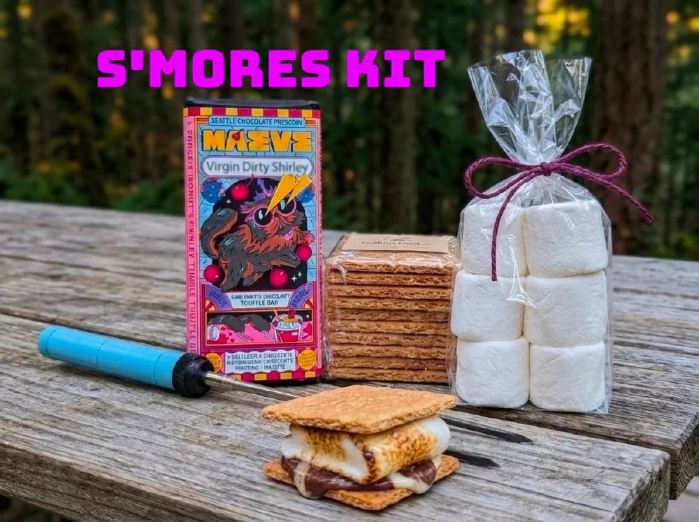
Add-on S'mores Kit
Day two: Longmire, Paradise, over the back way
The Nisqually Entrance is 25 minutes from camp, through Ashford. Fill up in Ashford if you’re low; there’s no gas inside the park.
Wildberry sits right on SR 706 in Ashford, on your way in — Nepalese, Sherpa-run, and a Mt Rainier lunch mainstay for as long as we’ve lived in the PNW. It opens at noon, so it’s worth it if the times line up and you don’t feel like cooking: lunch on the way up to Paradise, or dinner on the way back out if you’re taking a second night at Alder Lake. Closed Thursdays.
Trail of the Shadows and Rampart Ridge at Longmire, then up to Paradise.
Then on to Packwood. Resupply at Blanton’s, then start up FR 21 before about 4:00 so you’re setting up camp with light to spare.
Day three: slow morning, east side, burgers
Coffee in a camp chair with nobody around. There’s no reason to rush this one.
The Stevens Canyon Entrance is 20 minutes from Packwood. Silver Falls, then Stevens Canyon Road and Reflection Lakes. If the cloud ceiling is low, trade the whole thing for Packwood Lake and stay under the trees — it’s 4 miles in on an easy grade, and you can turn back whenever. A forest hike in a light drizzle is genuinely lovely — the trees take most of it, everything smells like fresh rain, and you leave the exposed ridgeline trails for a clearer day.
Thursday is the day Cliff Droppers opens in Packwood. Elk burger.
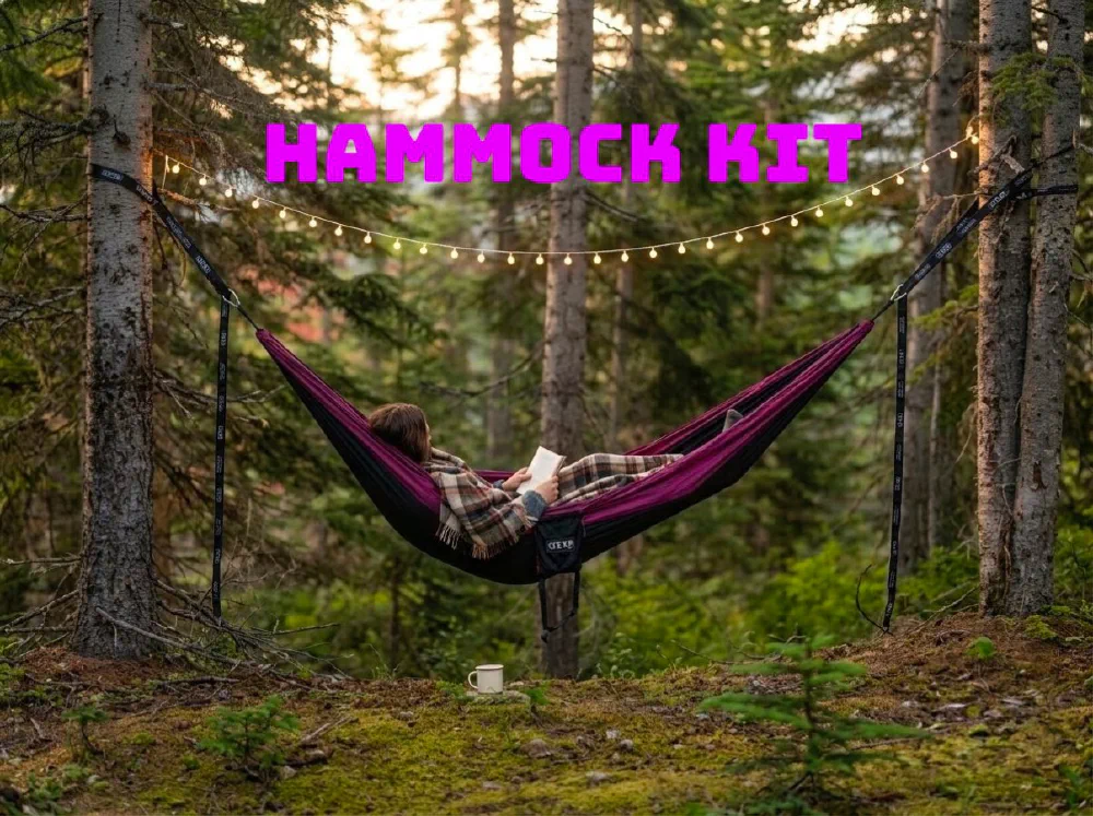
Add-on Hammock Kit
Day four: out over the passes
Hwy 12 east, SR 123 over Cayuse, SR 410 up to Chinook Pass. Picnic lunch at Sheep Lake, then 410 west through Enumclaw and home.
Splurge option: the Mt. Rainier Gondola at Crystal, 12 miles down from the pass, up to the Summit House at 6,872 ft. Scenic season ended September 20 and winter operations start late November, so check first.
Pick your hike
Nothing here is mandatory.
- Trail of the Shadows — 0.7 mi loop, flat, Day 2. Meadow, mineral springs, a homesteader’s cabin, enormous trees.
- Rampart Ridge Loop — 4.6 mi, 1,339 ft, Day 2. Lava ridge through old growth to two Nisqually Valley viewpoints. All under canopy, which makes it the best wet-day pick. Go clockwise.
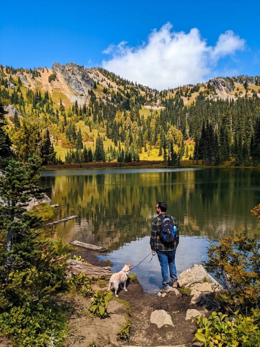
- Sheep Lake — 3.6 mi, 400 ft, Day 4. Our favorite picnic spot, and it sits on your drive home. PCT north from Chinook Pass into a meadowed bowl at 5,750 ft. Leashed dogs are fine here.
- Packwood Lake — 4 mi in, 9 mi round trip, 1,200 ft, Day 3. Gentle grade the whole way and paved road to the trailhead, but it’s a full day, so turn around whenever you’ve had enough — it’s an out-and-back.
- Silver Falls — 1.0 mi round trip, 300 ft, Day 3. The short rainy-day swap. Start from the Grove of the Patriarchs lot; the Ohanapecosh Campground trailhead is closed in 2026, so it’s out-and-back, not a loop, and the Grove itself has been closed since its bridge washed out. Stay behind the barriers at the falls — wet rock and cold, fast water.
If you want to forage
Chanterelles come up whenever it rains around old conifers. You want a relatively clear forest floor — moss and needle duff, well-drained — not a floor buried in ferns. Keep an eye out between about 1,000 and 3,000 feet.
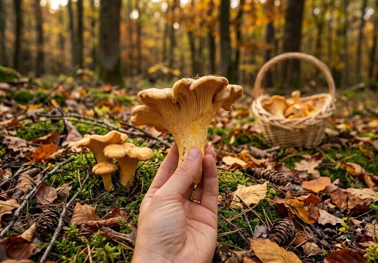
No foraging inside the national park — nothing leaves Mount Rainier, mushrooms included. Gifford Pinchot National Forest is the place. Try the lower miles of FR 21, before it climbs toward the camp — the camp itself sits around 4,600 ft, too high for them. Grab the free personal-use permit and the harvest-area map first, and check which areas are open: Gifford Pinchot forest products. Wilderness areas are closed to collecting.
Know what you’re picking, and if you don’t, leave it.
If you’re bringing the dog
Dogs are banned on every trail inside Mount Rainier National Park — Trail of the Shadows, Rampart Ridge, Silver Falls and the Reflection Lakes trails are all out, along with wilderness areas and snow. Leashed dogs are welcome on the national forest side, which covers Sheep Lake and the FR 21 camp. Six-foot leash, and they’re fine in parking lots and within six feet of open roads inside the park (NPS pets).
So: dispersed nights on FR 21, forest trails by day, and the in-park stops become roadside ones.
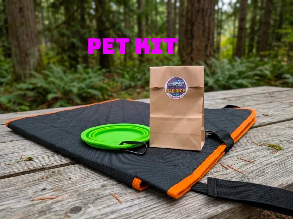
Add-on Pet Kit
Some food spots
For the nights you don’t feel like cooking on the camp stove. All small operations, so check the day before you count on one.
| Where | Hours & notes |
|---|---|
| Wildberry | Ashford, on SR 706 before the west entrance. Nepalese, Sherpa run. Noon to 8, closed Thursdays |
| Brewery | Packwood. Wed 3–9, Thu 1–9, Fri 12–10. Fireplace, patio, Rainier view. Ask about the water spigot |
| Cliff Droppers | Packwood. Thu–Sun, 11 to 6:45. Elk burger |
| Blue Spruce | Packwood. 11 to 11 daily, the Tuesday fallback |
| Daily | Blanton’s Market 7 to 10, Mountain Goat Coffee 7 to 5, Chevron 5 to 11 |
Before you turn the key
- Tuesday is Packwood’s day off. Brewery, Cliff Droppers and Butter Butte all closed. Wildberry is closed Thursdays.
- Cayuse and Chinook close on snow, not on a date. Last year it was October 24. Check WSDOT passes before Day 4; if they’re shut, go home the way you came.
- Stevens Canyon Road usually closes mid to late October. Skate Creek Road is the way around. Park road status.
- Wood fires are banned on forest land right now, but the propane fire pit is legal. Bans usually lift with the October rain. Ask the host if you’re in a campground.
- Cell service ends at the edge of Packwood. Download your maps offline in onX Offroad first — it’s what we use for every scouting trip.
- No timed entry reservations in 2026. Just $30 at the gate, good for the whole trip.
What the rig brings
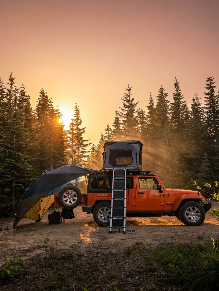
iKamper rooftop tent, bedding and wool blankets. Two awnings: the back kitchen, and a 270° Fox Wing off the side. Propane camp stove and propane fire pit. 3-gallon water keg and pump, filled before you pick up — figure about a gallon a day, so you won’t need a top-off until late in the trip. 500W power station. Fully equipped kitchen bag: pots, cast iron, utensils, spices, the basics. Camp chairs, table, headlamps, first aid, recovery gear, trash bags. Northwest Forest Pass and WA Discover Pass in the glovebox. Tire chains, just in case — snow is unlikely in mid-October and the 4x4 is plenty, but it’s been an odd weather year. Microspikes, hiking poles and a Stanley growler to borrow, available on request. Printed Field Manual.
What you bring
- A real rain shell with a hood. Waterproof, not water resistant.
- Two pairs of shoes, two pairs of socks. Waterproof boots and camp sandals, wool not cotton.
- Layers for 35 degrees: fleece or puffy, beanie, gloves.
- Quarters for the showers at Alder Lake.
- Your America the Beautiful pass, if you have one.